Day 1/20 The Pennine Way 429km - Edale to Crowden - 28 Jul 2009
>> Monday, 17 August 2009

The Pennine Way, along the backbone of northern England, is the first to be opened as a National Trail. To some people, it's the best; it's certainly the best known and it's arguably the hardest. It requires fitness, determination, good humour and adaptability because the walk won't go smoothly all the time.
I've decided to do the Pennine Way a few months ago, with lots of uncertainty whether I'm capable of completing it all at one go. The initial plan was to spilt it up into 2 or 3 parts, but eventually I chose to complete it at one go as a challenge. Before this walk, I have only done walks which amount to a maximum of 6 days. Hence this 17 + 3 (rest days) = 20-day walk will be a test of my determination.
27.8km, 911m ascent, took 8 hours (no rest)
I arrived at Edale by train early in the morning. The Old Nag's Head marked the official start of the Pennine Way. A quick photo, and off I went. Time check: 1107. It began to drizzle soon after I started - an unwelcoming beginning. Gloomy skies, fortunately visibility was not affected much.
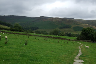
The inaugural stage passed through the hamlet of Upper Booth - a pleasant amble through the upper pastures of the valley. Edale looked familiar to me, obviously, because I had hiked there once. But it appeared different this time - the distinction between winter (snow) and summer (greenery). Which do I prefer? I guessed it's the winter one. But summer would be easier for walking - less slippery and warmer.
Taking off with my new hiking socks was a great pleasure! It felt bouncy when I walked. So much more comfortable! Lots of cushion to absorb any impacts. It was worth the money! Somehow, I still believe that money and quality go hand in hand. :)
Thereafter, I followed the stiff ascent of Jacob's Ladder before reaching the open moorland. The climb was challenging, but it being the first day, I was full of energy, therefore the steep climb was not too hard for me.
At the peak of Kinder Low, there was a white 'trig point' which was clearly visible, at least on a clear day like today. The route then descended to take an impressive arc along the Kinder Edges - the plateau's western rim. Met several walkers up there, but it seemed that none of them were doing the Pennine Way. They were just there for day walks.
Beyond the impressive but rarely flowing Kinder Downfall, I left the plateau rim for the steep stepped descent to William Clough (*clough is a stream) and the Snake Path junction near Mill Hill. Next, it was the crossing of a large wild moorland which took me an hour! It was quiet except for the incessant planes landing at Manchester Airport that spoilt the peace. I finally reached the end of the moorland, and crossed the highway A57 'Snake Road' - interesting name!
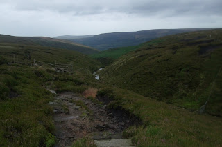
It was then along the sunken track known as 'Devil's Dyke', heading towards Bleaklow Head. Dark clouds blew overhead, and rain with strong wind came pouring down. My shoes started to get wet because of rain sipping through the tiny gaps at the top of my gaiters. Like that also can! Hiaz... There were lots of scrambling along a stream in the sunken track. Getting muddier, wetter. And finally, I came upon Bleaklow Head - a distinct stake stuck in a heap of stones.
Then came the horrible part. Too many likely-looking paths confused me and I...haha..got lost! Somehow, I didn't know why, but I kept heading north, when I was supposed to be heading west first, then north-west. I knew I was getting lost, till I really got lost! No paths under me. It was just trampling over moorland with hidden holes, ... I got very muddy and wet: Fell several times; hit my lips causing an ulcer; slided over soft mud; sunk into pools of muddy water. I felt terrible then. Worried too. Took out my OS map and got it muddy. After almost 2 hours of getting lost, I figured out where I was exactly and had to make a big detour to reach the correct path. Thank goodness! Rain had got heavier then and I was totally drenched. Shoes had turned into a fish tank!
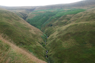
Finally, it was all downhill to Longendale Valley along the rim of Clough Edge - a deep heather-clad gully, from where an underwhelming panorama of reservoirs and plantations revealed themselves far below. I felt anxious walking so close to the valley edge. The path was muddy and very slippery. My fears just proved one point - I'm afraid of heights.
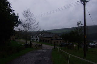
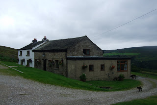
I reached the road after lots of scrambling and descents which had bad impact on my knees. I headed off the Pennine route to go to 'The Old House' B&B where I would be spending my 1st night. I had the 3-bed room all to myself. Facilities were shared. It felt more like a bunkhouse. Dinner was Steak Pie in the dining area of the B&B. Lots of washing and drying before diary time and then good night! :)










0 comments:
Post a Comment