Day 1/2 Edale 11.3km Walk - Rushup Edge & Mam Tor - 14 Feb 2009

>> Tuesday, 9 June 2009

These 2 days in Edale marked the most memorable and challenging walk I've ever done before. I'm very thankful to the newly founded 'brotherhood ramblers' founded in Feb 09...consisting of Ah Neh, Lawlaw, Faithie and myself for making this hike a success and the completion of it was purely through persistence, endurance and encouragement.

6am: Left home and made our way to Megabus stop, where we boarded the bus to Sheffield Meadowhall. The train then took us down south to Edale.... No one expected what was coming. We just knew that there was a small adventure awaiting for us. No one expected how tough the hike was going to be. All of us, except myself, had never done anything like that before. Myself, I was just afraid of getting everyone lost. It only occurred to me on the train that the tracks were going to be covered with thick snow, and navigation would impose a big problem. Oh dear...getting worried...but no turning back....


Arrived at Edale. It began with Faith's classic pose at the Edale signboard during phototaking. Then...field paths and quiet lanes led us across the Vale of Edale, before the snowball fights commenced along the rough track (Chapel Gate) which climbed steeply up onto the broad ridge of Rushup Edge. At the peak of the climb, we took a break - banana, muffin, ...poses by the 2 male partners...the littering and burying of banana skins in the snow...


The never-ending and super tiring walk continued along the narrow ridge with stunning views down across the head of the valley towards Kinder Scout. If it had not been winter, the walk should have been a simple one. But the thick snow which was probably as high as my chest level was slowing everyone down. Every step we made, there was high likelihood of our legs sinking straight into the deep snow up to knee level. Imagine how exhausive the walk was: Every step we took, we had to lift out legs high up to make our next step. Phew...the ridge walk seemed endless.


The ridge finally took us to join the road at Mam Nick at the foot of Mam Tor. A short but steep climb led up onto the summit of Mam Tor (517m high) where a path headed across the ridge to Hollins Cross. A rough path then dropped steeply down to join a track near Hollins Farm that led down to join the valley road. During the descend, the ice was so slippery and it was scary to start sliding down, yet we had to admit that it was really ...fun .... :)


Finally, field paths led us back to Edale. It was at this point where the 'cow dung' adventure started. Lawrence and I took the muddy track, while Faith and Ah Neh went into the fields thinking that it would be less muddy...yet not expecting it was full of cow dung!!! So...it happened that Faith's shoes went into the cow dung and got stuck inside. Foot out but shoe still resting comfortably in the cow dung. After getting the shoe out, she tried wearing it back with the help of Ah Neh's finger, which got STUCK in her cow-dung shoe after she managed to wear it! Wahaha!!! Classic!!!!!!!!!!

Day 1 walk ended after 5.5 hours of adventure. Humorous and memorable experiences, though tiring. We eventually returned to Edale safely but wet (from the snow) and cow-dung-ish. Had dinner at the Inn/Pub -Old Nags Head. It had obviously turned dark when our dinner ended. Then the next problem was: How do we find our way to the Youth Hostel? It was about 2.4km away, and the path there would be through pitch darkness. If we were to take the road route, it would be a much longer distance. By then, we were quite helpless. So and SO fortunately...Ah Neh and Faith were daring enough to approach a car driver to ask for directions, while hoping that out of pity, they would offer us a ride to the Youth Hostel. And...tata!! We did it! We arrived at the Hostel SAFE AND SOUND.

What an adventure! More adventure coming up tomorrow....and no one expected that the walk the next day would be much much tougher! Stay tune!

Read more...

Dales 15.2km Walk - Simon's Seat - 28 Dec 2008

>> Tuesday, 26 May 2009

This is the first walk which I did with a group. Felt more relaxed as I would be with experienced walkers who would be doing the navigation for us. Now, it would be just walking and admiring the scenery around, without having to worry of getting lost. However, I felt there was something amiss: It seemed that I was just following ....and following blindly, without much of a clue of where I was exactly on the map. There was the lack of silence/ sound of nature. Too much noise, too much talking, too much footsteps, ... Nevertheless, it was good to have a mixture of both kinds of experiences.

I asked Zixiang along for this walk with the Dalesbus Ramblers who I met in the Grassington pub during my previous Dales walk. Took a train to Leeds the day before, and stayed in a B&B. Had to do so in order to catch the earlier train to reach Ilkley on time. Met Duncan (one of the Ramblers' leaders) on the train. At Ilkley, joined the rest of the dalesbus ramblers where we took the bus to the starting point of the walk - Bolten Abbey (Cavendish Memorial).

It was quite an easy walk with some gentle ascends: along River Wharfe, before straying away from it to cross some pastures and plantations. Passed a few waterfalls. Finally emerged from the plantations out into the exposed moorland where the real climb began - all the way up to the top of Simon's Seat (Trig point: 485m above sea level). A bit of panting and strain on the legs towards the end, but we were all rewarded with a breathtaking view of Yorkshire Dales. Towards North-West was where I did my previous walk - at Appletreewick. "Something I like about the Dales is... the different shades of greenery that define the rolling pastures and hills. It kind of looks very similar in every direction you view. Not very complicated. Maybe just a little boring after being there several times." Anyway, we had a break at the Seat. Lunch - some packed sandwiches, while trying very hard to withstand the strong cold wind. Gloves were not helping. Fingers and face were totally numb and painful. Quite unbearable!


Then, the tough part came: the steep rocky descend to the bottom of the hill. I have always feared steep descends. It was scary. Any slip would mean ??!!!?? Should have invested in walking poles, but till now I never bothered about purcharsing them as it would just mean adding on weight to my load. Descending also put a lot of pressure on knees. Couldn't help it though...So the irony: Love climbing...Fear descending..Hahaha!!!


The rest of the paths were flat, leading us back to Burnsall, passing Appletreewick. Was having some abrasions by then, and wasn't really enjoying the last part of the walk. Finally arrived at Burnsall at 4pm. That meant we had walked for about 5 hours - Not too long, just about the right length to not feel very exhausted. While waiting for the Dales bus back to Ilkley, we had some coffee and dessert at a Tea Room - a nice cosy place for rest. Bus finally arrived, so back to Ilkley, then train to Newcastle, via Leeds and York. A long day but at least we had achieved something over the weekend, rather than rotting at home. More upcoming walks after January exams...stay tune!


Read more...

Dales 16km Walk - Grassington, Conistone & Lea Green - 30 Nov 2008

It was another great day for walking. Though chilly - 2 degrees, the sun was up. Dry. Perfect visibility. :) I left Holly Tree Farm (Thorpe) after a very filling 'English Breakfast'. It was 10am then. The walk to Grassington where I started my official walk took an hour, passing endless stretches of whitish-green fields. The unique colour was due to frozen water droplets/ ice on the grass. Beautiful!


The walk today took slightly longer than the previous day's. From Grassington (an attractive small town set amongst the rolling hills of Upper Wharfedale with its picturesque cobbled square, stone cottages and winding alleyways), the next 4 hours took me through Grass Wood Nature Reserve, Conistone and Lea Green. Grass Wood is a beautiful swathe of ancient semi-natural woodland that once formed part of the much larger Forest of Wharfedale. It is a fascinating place with many native tree species including oak, ash, hazel and birch as well as over 70 varieties of flowering plants that thrive in the calcareous soils beneath the tree canopy. It was a pity that I did this walk during the winter, hence there wasn't much left to admire. However, hidden amongst the trees were the impressive stone ramparts and ditches of an ancient British hill-fort known as Fort Gregory - a well-preserved remains of a small Iron Age settlement. Getting lost added on to my adventure. I stupidly made a wrong left turn, and experienced quite a hilarious adventure of squeezing through dense woods. After some time of trial and error, I managed to get out of the Grass Woods by a different exit. But...at least I was out of the 'forest'! Phew!


I followed the road, by the river, reaching the Conistone with superb views towards the impressive bulk of Kilnsey Crags. Conistone is an attractive Craven village that boasts many fine old farmhouses, a large maypole and the oldest church in the southern Dales. From Conistone, a footpath led up through spectacular dry limestone valley of Constone Dib - one of the 'natural wonders' of the Yorkshire Dales. This deep steep-sided gorge was scoured out by glacial meltwaters towards the end of the last Ice Age when the permafrost prevented the water from seeping down through the limestone bed-rock. In places, Conistone Dib closed in to little more than a narrow passage beneath towering limestone crags, whilst the 'lip' of this dry valley was a narrow cleft in the rocks that required quite a bit of scrambling and climbing. It was fun and exciting to do some 'small-scale rock-climbing'!!! Was rewarded with a stunning view at the top of the valley! I paused to admire it! :) "Best walk ever," I thought.


Next section of the route was following the gradually-ascending grassy paths across rough grassy moorland to reach Bare House Farm - a deserted farmhouse situated high on Grassington Moor. It was said to be the place where the early Viking settlers stayed. Finally field paths led back down across Lea Green (Iron Age settlement) to Grassington where I ended my walk for the day.


Time for some sightseeing around the interesting town, even though I had been there for quite a number of times during my previous host UK visits. Had a lick on an ice-cream, followed by dinner at a pub accompanied with half a pint of Calsberg....while waiting for the bus. Was a coincidence that a friendly guy saw my walking gears and started chatting with me. I learnt that he was part of the Dalesbus Ramblers who did free guided weekend walks. Anyone was welcomed to join...which I did for some of my next few walks. From what I saw, most of the ramblers in the group were retired people. I was impressed by the healthy lifestyle most UK people live by. I hope to retire in the countryside...will see...*wink* :)

Read more...

Long Distance Walk 1

Long Distance Walk 1
Northumberland 151km Circular Walk

Long Distance Walk 4

Long Distance Walk 4
Northumberland Coast Path 103km Walk

Long Distance Walk 7

Long Distance Walk 7
Cumbria Way 127km Walk

Long Distance Walk 2

Long Distance Walk 2
Yorkshire Water Way Vol1 66km Walk

Long Distance Walk 5

Long Distance Walk 5
Pennine Way 429km Walk

Long Distance Walk 8

Long Distance Walk 8
East Highland Way 132km Walk

Long Distance Walk 3

Long Distance Walk 3
West Highland Way 152km Walk

Long Distance Walk 6

Long Distance Walk 6
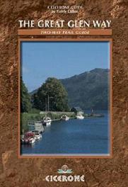
The Great Glen Way 117km Walk

  © Blogger templates Shiny by Ourblogtemplates.com 2008

Back to TOP