Showing posts with label Yorkshire Dales. Show all posts

Upper Wensleydale 24km Walk - Hawes - 28 Jun 2009

>> Tuesday, 28 July 2009

Being an Inn Way member, I was invited to free quarterly guided walks by the author - Mark Reid. Due to various commitments, I missed the previous 2 walks. Hence this time would definitely be a no-miss.

I stayed in Hawes YHA the night before, after hopping down from a train from Scotland. That morning, I headed to the meeting point - Dales Countryside Musuem, where there were a few walkers waiting. Not many (about 5), and I was the only 'young' (younger) one. Mark (and his pet dog, Elvis) was late, as earlier warned by the other Inn Way walkers who had been to walks with him. They had known him for quite some time now.


We finally set off, taking part of the Pennine Way before making a turn left along field paths and rough pastureland to Cotterdale, with a steady climb up onto Bluebell Hill (370m). I was surprised that all of them were fast walkers, especially Mark and a couple. Lots of walking usually, i guessed. Elvis was quite an old pointer, not very well trained/ obedient, as admitted by Mark, it being his first dog. It was not very strong, so Mark had to carry it over stiles/ ladders to get it over the fences. Quite a funny sight!

From Cotterdale, forest paths and tracks led steeply up onto the open moorland of Dry Gill Head/ tarn Hill where a narrow path led down to the abandoned farmhouse of High Dyke before dropping steeply down across pastures to reach Moorcock Inn at the head of Wensleydale. That was our 45min lunch stop, where I had a pint of beer. The rest had about 2 each. I am not a water drinker, somehow I do not have to drink as much as others usually..which I thought is a good thing...that means I will not have to bring lots of water with me and also less worries about looking for toilets. :)


When we left the Inn, the sun had grown brighter, making the air more humid and warmer. My thermometer had hit 27 degrees! The 'return' leg followed field and riverside paths as well as farm tracks all the way back to Hawes. We had another drink at another pub before going our separate ways. I headed back to YHA where I spent one more night before returning home the following morning.


Whether I had enjoyed the walk? Erm, felt it was a bit lengthy and boring after seeing too much greenery for hours. The group of walkers were not as sociable as I had expected, making me feel a little out of place at times. Nevertheless, it was the first time for me at Northern Yorkshire Dales and I had a good relaxing breakaway from the city. :)

Read more...

Dales 12km Walk - Great Whernside - 24 May 2009

>> Thursday, 23 July 2009

Ever since the last West Highland Way 6-day walk in Easter, it had been 2 months of recuperation. This Great Whernside walk was done in the midst of my examination - had completed 2 papers this week; 2 more to go in the next 2 weeks. It was a planned day off for myself to meet up with the Dalesbus Ramblers as well as a test of my leg recovery.

Great Whernside is a mountain in the Yorkshire Dales, England. Its summit is the highest point of the eastern flank of Wharfedale above Kettlewell. The curving escarpment above the pass between Wharfedale and Coverdale is known as Whernside, of which Great Whernside is the highest point. I've climbed the Great Whernside a year ago, coming up from Kettlewell. This time, the walk would be slightly different - starting at Starbotton and finishing at Kettlewell.

I took the train from Newcastle that morning, towards Leeds, then to Ilkley, followed by a bus to Starbotton. The bus ride was 1.5 hours: really long! I had texted Duncan (the Dalesbus Ramblers' leader for this walk) this morning that I would be joining them in their walk, but would be arriving at the starting point 30 min late since there was no earlier transport. Therefore the plan was to meet them somewhere along the trail towards the peak...hopefully I wouldn't get lost. :P

Starbotton is a small limestone village, 15 miles north of Skipton situated midway between Kettlewell and Buckden in the beautiful countryside of Upper Wharfedale. I finally set off and started the climb using my OS Explorer map and the sun for directions (my compass didn't seem to be working that day). I had roughly guessed and traced out the route to take before I embarked on this walk. I was just praying that this was the route the Ramblers had taken. So off I went! I felt I had gained more confidence with hill navigation. Although my compass was not working, I managed to find my way around accurately. Thanks to the clear day - easy to spot the terrain and visualise contours from the map. Improving, great job!

It was a hot and humid day. 28 degrees celsius! Can you believe it???!!! I removed my ski jacket half-way up the climb, and wore my sunglasses to shield off the glaring sunlight.


After a short climb of less than an hour, I noticed a group of walkers resting at the side of a slope. A few of them waved at me, and I spotted Duncan and about 3-4 others whom I had met in our previous Simon's Seat walk. Yipee, I had caught up with them. Now, I would be in safe hands. :)

We climbed up to the top of Great Whernside (abt 700 m above sea level; 500 m of ascend) The peak brought back some vague memories of my last year's climb when I ran into adverse weather condition (raining and extremely foggy). This time, the weather condition was exactly the opposite, and obviously much preferred by all. We rested at the trig point while waiting for the other half of the group who had separated and lagged behind. However after some waiting, we decided to move on as some of the walkers had to catch the earlier bus home.


The steep rocky descend was a little appalling as usual. We got over that section quickly and continued along field paths which led us back to the little village of Kettlewell - "the peculiar abode of peace and quiet beauty; its limestone terraces, with their fringes of hazel and rowan coppices give to the district a characteristic beauty". It finally concluded with a pint of Heineken at a pub and ice-cream at a cafe, before catching the bus and train home that night.


Comments on this walk: 4.5 hours/ 12km. Not too tough. Although it involved lots of steep and sustained climbing, my stamina and endurance had been good. I guessed the main reason for the ease was the absence of a heavy backpack. That had made a huge difference. Also, had a bit of sunburnt and uneven tan caused by my sunglasses. Leg - full recovery...Great!

Read more...

Long Distance Walk 1

Long Distance Walk 1
Northumberland 151km Circular Walk

Long Distance Walk 4

Long Distance Walk 4
Northumberland Coast Path 103km Walk

Long Distance Walk 7

Long Distance Walk 7
Cumbria Way 127km Walk

Long Distance Walk 2

Long Distance Walk 2
Yorkshire Water Way Vol1 66km Walk

Long Distance Walk 5

Long Distance Walk 5
Pennine Way 429km Walk

Long Distance Walk 8

Long Distance Walk 8
East Highland Way 132km Walk

Long Distance Walk 3

Long Distance Walk 3
West Highland Way 152km Walk

Long Distance Walk 6

Long Distance Walk 6
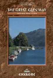
The Great Glen Way 117km Walk

  © Blogger templates Shiny by Ourblogtemplates.com 2008

Back to TOP